Cartographical maps and networks
Antonio Rivero Ostoic
August 2022
Source:vignettes/Maps.Rmd
Maps.RmdPreliminaries
Install and load a version of "sdam" package.
install.packages("sdam") # from CRAN
devtools::install_github("sdam-au/sdam") # development version
devtools::install_github("mplex/cedhar", subdir="pkg/sdam") # legacy version R 3.6.x
# load and check versions
library(sdam)
packageVersion("sdam")
[1] '1.1.1'Cartographical maps
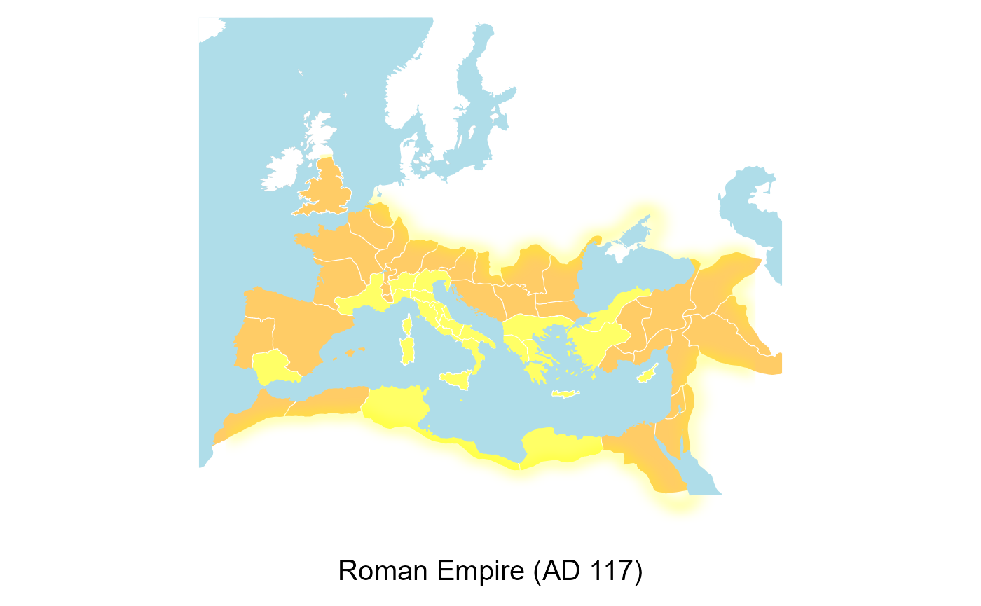
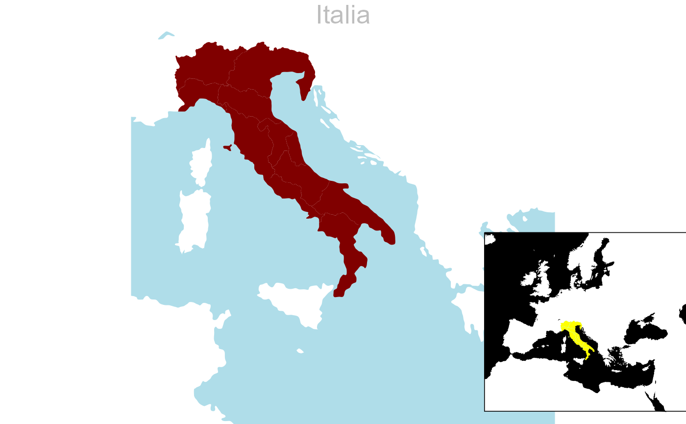
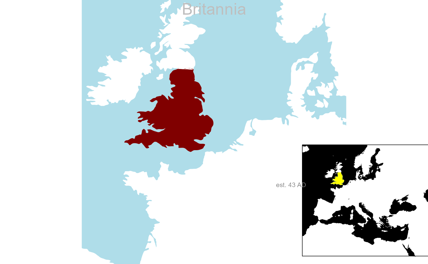
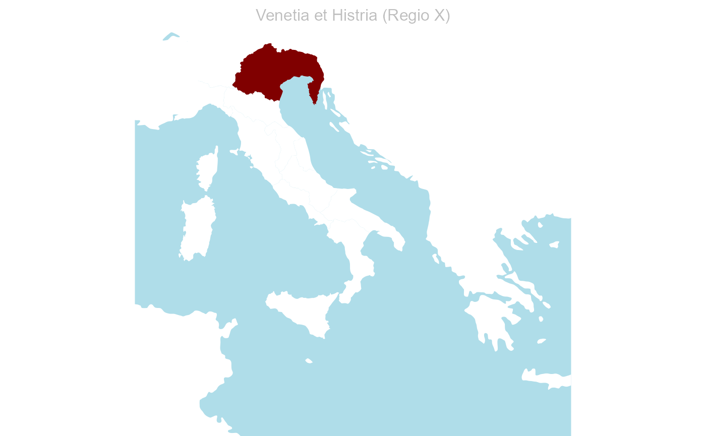
Cartographical maps of Roman provinces under Emperors Trajan and Hadrian (year 117AD), and Italian regions under Emperor Augustus (year 27 BC) are part of the suite of datasets of the "sdam" package. For instance, four cartographical maps related to the Roman Empire in the antiquity period are available in dataset "retn" that is loaded by function plot.map() to depict cartographical maps and transportation systems. plot.map() is an interface that also invokes datasets "rpmp" for names and vector shapes of Roman provinces and regions, and dataset "rpmcd" for including map captions and dates in the plot.
Political division
Plotting political divisions of the Roman Empire needs the 'type' argument of function plot.map() as well.
Roman provinces and regions
- Roman provinces and regions shapes and colours for
plot.map()are in dataset"rpmp", while the acronyms inxare as in dataset"rp".
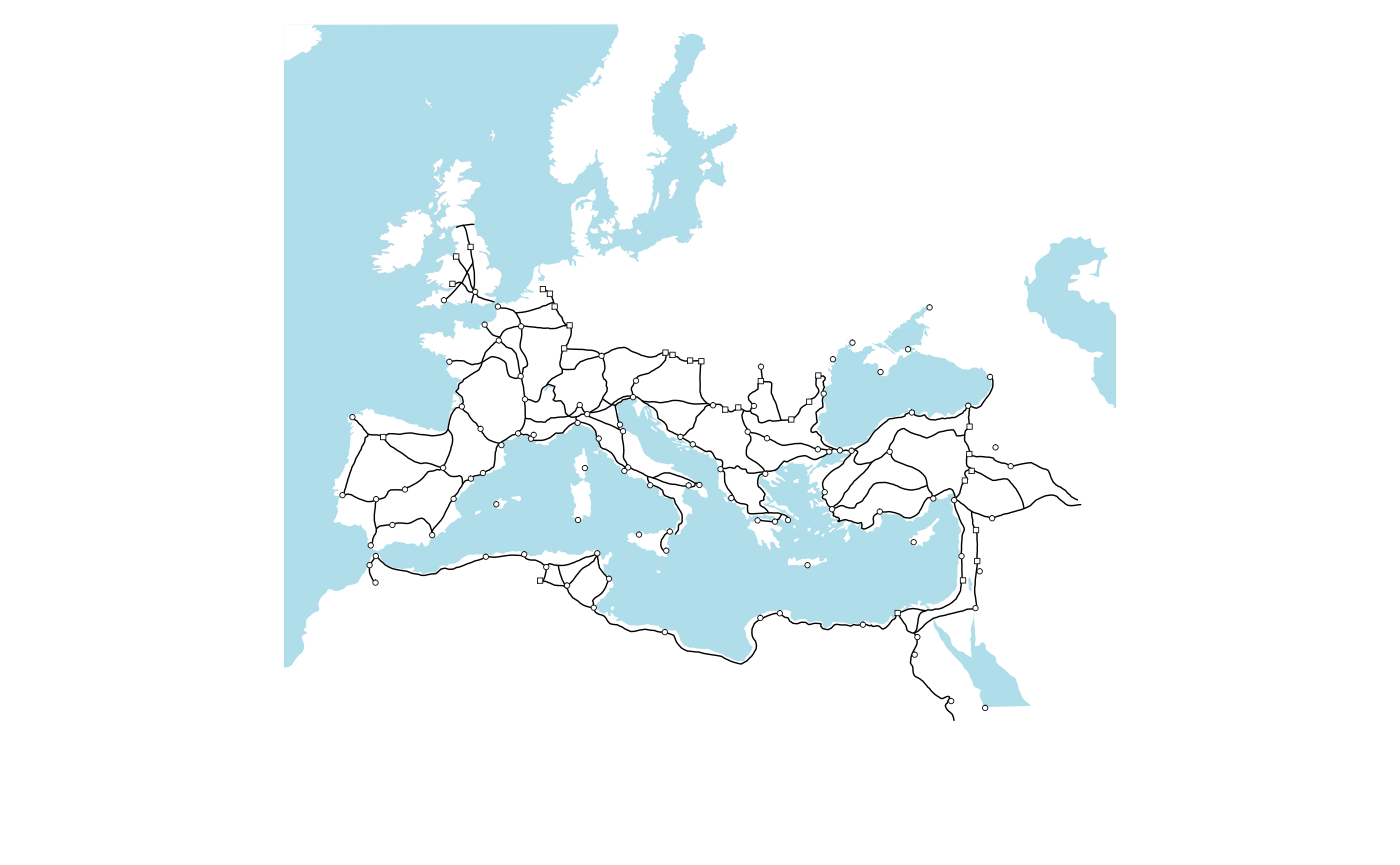
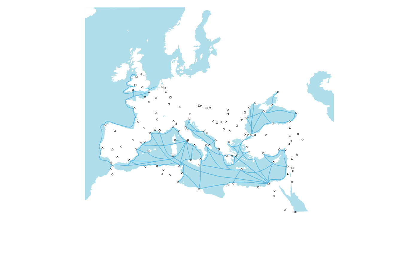
Transportation system
A plain cartographical map with a Roman transportation system made of settlements and terrestrial and maritime routes is possible with the type argument in plot.map(), or else by specifying with arguments settl, roads, and shipr for the settlements and this routes in the transportation system.
Graphs
Shipwrecks network
Graph representations of the transport network is possible with packages "multigraph" and "multiplex".
Access to the shipwrecks dataset.
# shipwrecks dataset
sw <- system.file("extdata","StraussShipwrecks.csv",package="sdam") |>
  read.csv(sep=";")
# variables are checked
colnames(sw)
[1] "Wreck.ID" "Strauss.ID" "Name"
[4] "Parker.Number" "Sea.area" "Country"
[7] "Region" "Latitude" "Longitude"
[10] "Min.depth" "Max.depth" "Depth"
[13] "Period" "Dating" "Earliest.date"
[16] "Latest.date" "Date.range" "Mid.point.of.date.range"
[19] "Probability" "Place.of.origin" "Place.of.destination"
[22] "Reference" "Comments" "Amphorae"
[25] "Marble" "Columns.etc" "Sarcophagi"
[28] "Blocks" "Marble.type" "Other.cargo"
[31] "Hull.remains" "Shipboard.paraphernalia" "Ship.equipment"
[34] "Estimated.tonnage" "Amphora.type" A system of maritime routes is found in variables Place.of.origin and Place.of.destination, which correspond to columns 20 to 21 in sw. This edge list needs some transformations with functions from packages "sdam" and "multiplex" to be able to plot the shipwrecks network as a directed graph with loops with a force directed layout.
# graph of shipwrecks network
sw[, 20:21] |>
  sdam::cln(level=2, what=c("(",")"), case=1, na.rm=TRUE) |>
  multiplex::transf(type="toarray") |>
  multigraph::multigraph(layout="force", seed=123, loops=TRUE, ecol=4, sel="Rome")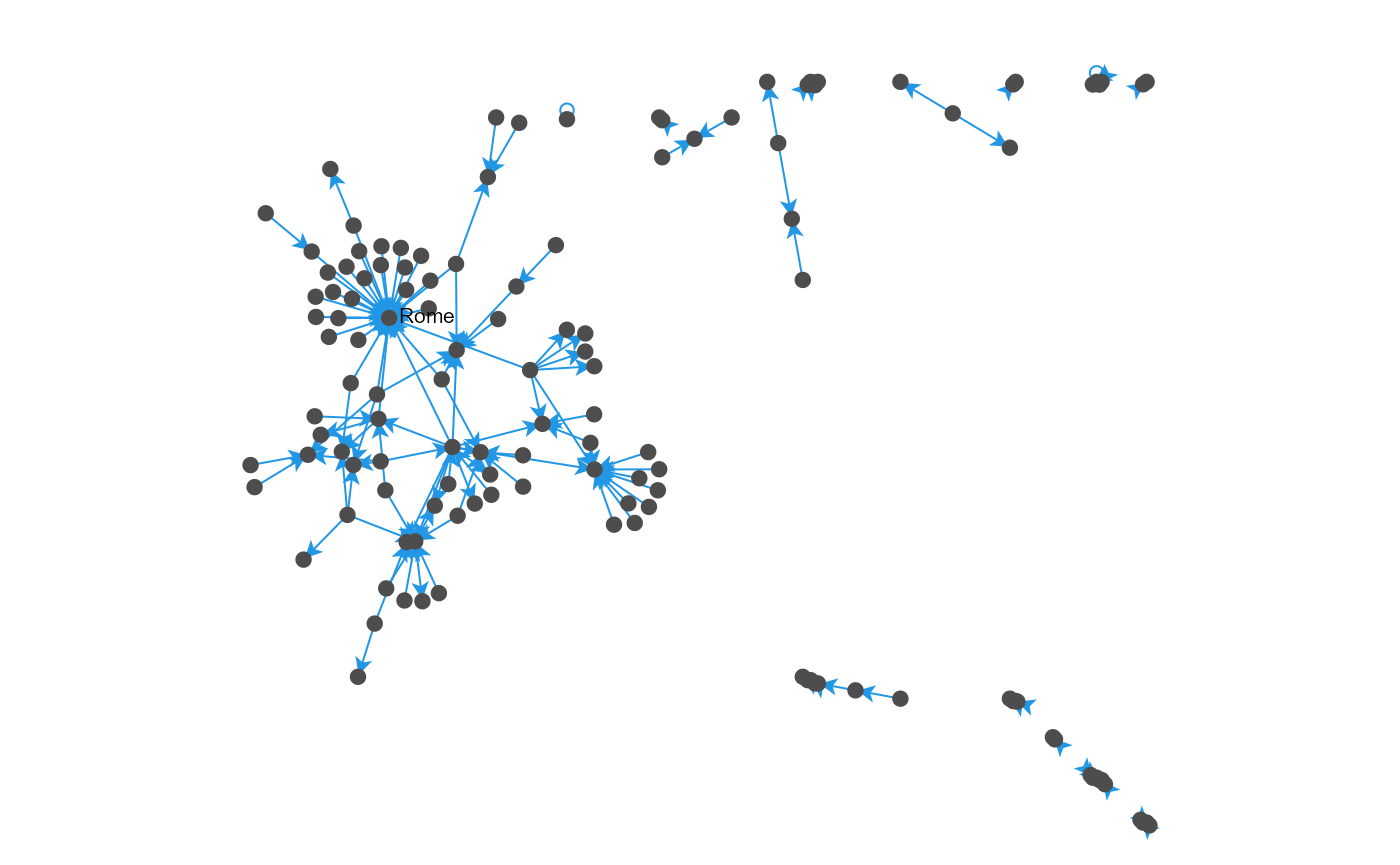
In this case, a single node is labeled in the graph that represents the shipwrecks network without missing information. To keep records with NA in the data, function cln() has the 'na.rm' argument to be set to FALSE.
References for shipwrecks data are in
- Vignette Datasets in
"sdam"package
¨